In an epic weather event affecting most of the West Coast on 26 March 2019, attention was focussed on the dramatic washout of the Waiho Bridge near Franz Josef, cutting the West Coast highway. In response, the West Coast Regional Council has suggested that a long-term strategy to safeguard the area is to remove stopbanks constructed in the 1980s.
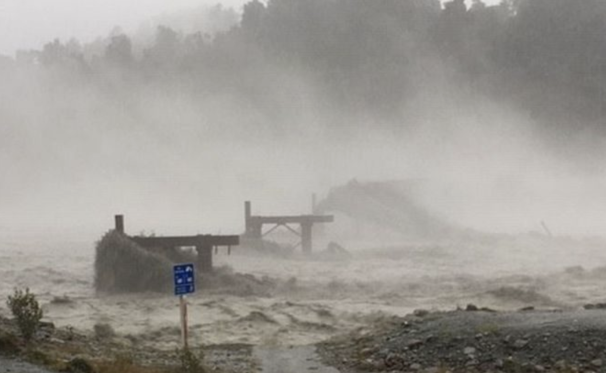
Knocking down stop-banks seems a perverse response to flooding, especially when it could result in the loss of farmland, but here’s the rub: before it was farmland it was floodplain. Recent heavy rain resulted in the collapse of the bridge crossing the Waiho river, not for the first time. The rain event was extreme even for the area – about 300mm in 24 hours, close to the monthly average for the area. The Waiho flows from the snout of the Franz Josef glacier, a major draw for tourists visiting the West Coast which is renowned for spectacular scenery and rain. The abundant precipitation in the west of South Island New Zealand is an integral part of its ecology and intimately linked to its landscape. Briefly, air laden with water vapour from the ocean is pushed from the west in response to Earth’s rotation.
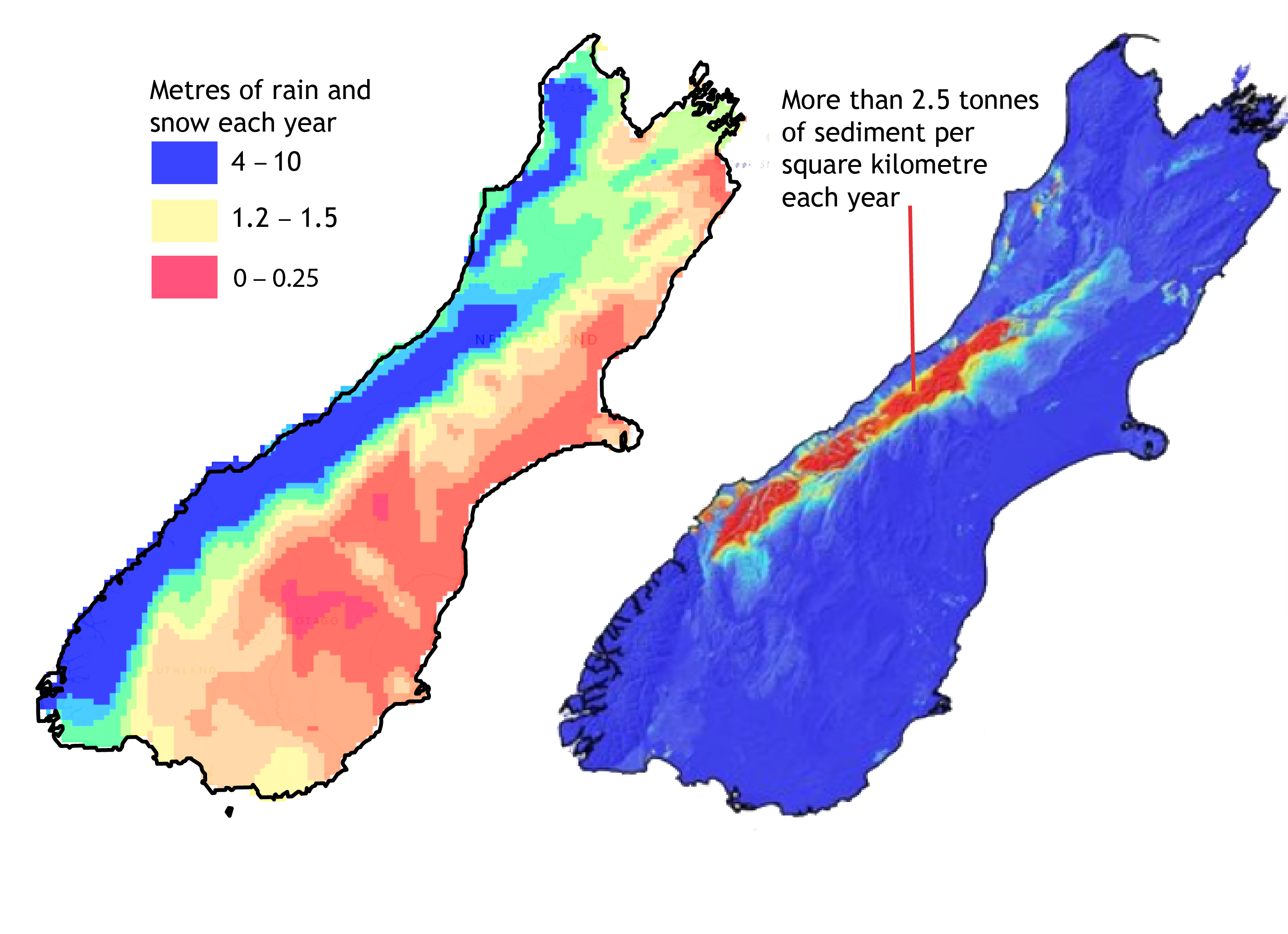
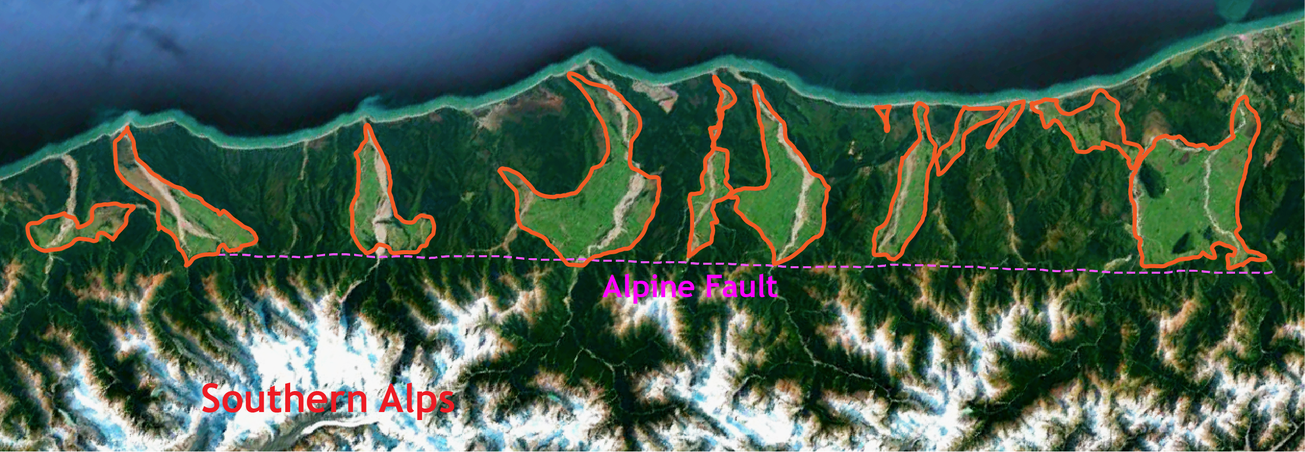
This weather circulates the southern seas largely unimpeded by land for at least 30 million years, since Australia and Antarctica were separated by tectonic forces. However, in South Island New Zealand, the Alpine Fault represents the collision of two tectonic plates that resulted in up-thrust of rock strata and eventual formation of the Southern Alps about 5 million years ago. The Southern Alps get in the way of some of the humid westerly wind forcing it up to cooler altitude where water condenses and falls as snow or rain. This orographic rain explains the huge difference in conditions between the wet west and dry east of the island. It also explains why glaciers flow down some west coast valleys, why the Southern Alps were so heavily glaciated during the Last Glacial Maximum 20,000 years ago, and why erosion rates are so high. The immense amount of water and sediment coming down from the mountains makes a powerful porridge that is a feature of braided rivers and alluvial plains in the region.
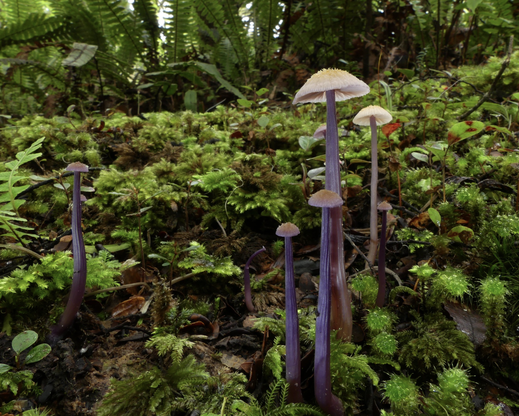
Downstream from the ill-fated Waiho bridge, the river weaves its way across flat land formed from sediment previously brought down to the area by water. The land here is therefore a product of the alpine erosion (just as the Canterbury plains are), and as such has supported for millenia an indigenous wet forest and wetland vegetation spanning sphagnum mosses to giant rimu, kahikatea and southern rātā. Here lives a highly diverse fauna and flora with many species particular to the region (e.g. Okarito kiwi, several lizards, carnivorous snails, the world’s only green cave wētā) and many newly discovered species awaiting formal recognition. This low-lying flatland environment includes some of the most extensive areas of New Zealand wetland habitat, of which less than 10% remains. But this environment is also highly valued for conversion to agriculture and in particular dairy pasture. Pasture conversion means replacement of the indigenous habitat and its fauna and flora with a handful of European plants and cattle with their associated ejecta.
Forest floor © Steve Reekie 
Green cave wētā © Danilo Hegg 
Cobble skink © Tony Jewell 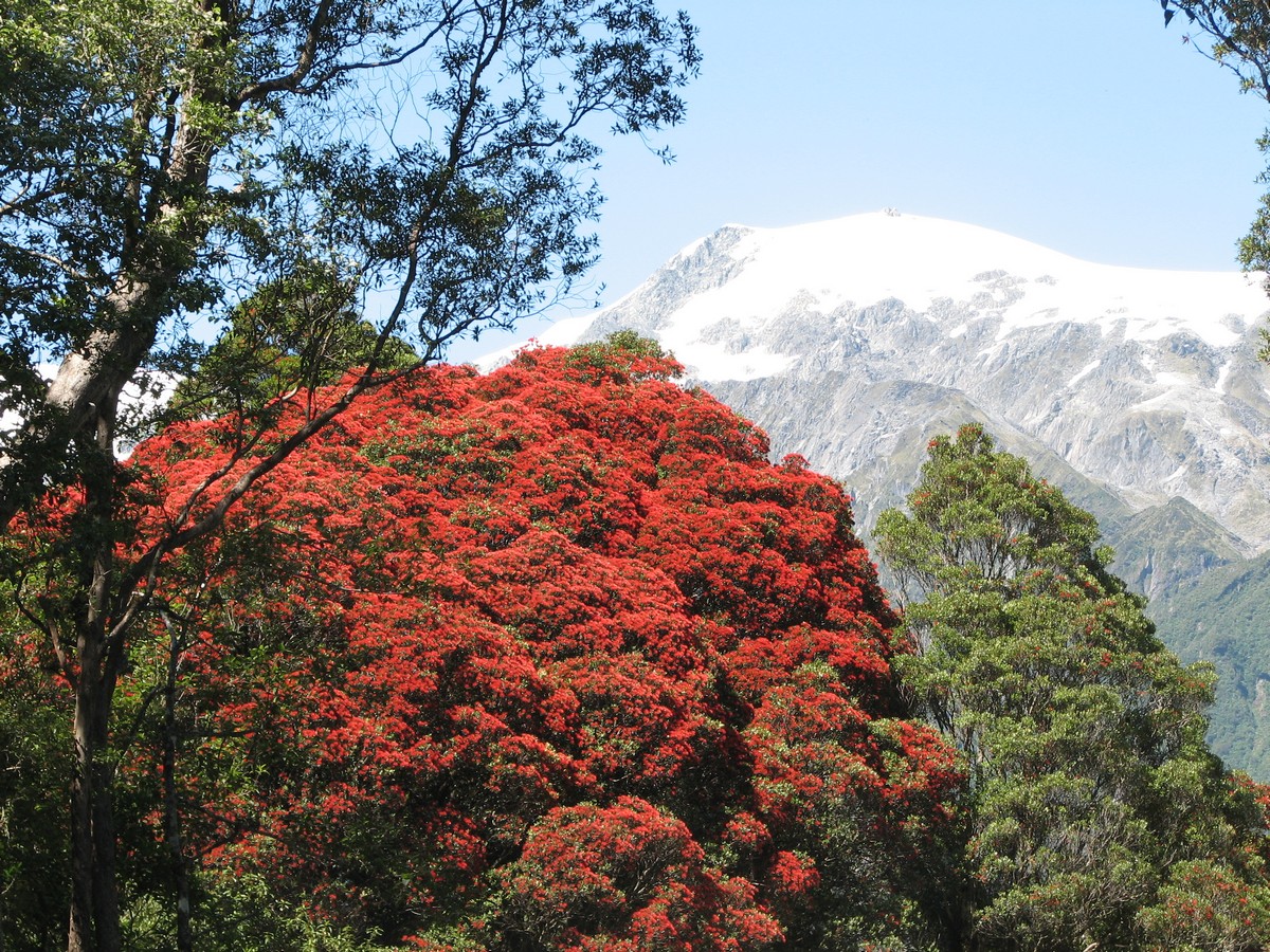
Southern rātā at Franz Josef
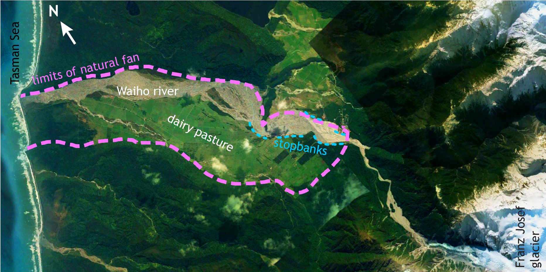
To achieve this transformation the natural floodplain of the Waiho River has been engineered (as have many New Zealand rivers) to restrict water flow using stopbanks bulldozed from the river bed. This approach seeks to reduce the meandering habitat of rivers with low slope so that land can be cleared and managed. At Franz Josef it became apparent more than 10 years ago that once created the stopbanks increased the accumulation of sediments upstream by confining the fanhead near where the road (SH6) crosses the river. This aggradation (raising of land) that is linked to failure of the bridge results when the rate of sediment supply is greater than the rate of removal, and did not happened prior to human intervention when the river occupied the wider flood plain.
So, despite the phenomenal disruption to the families involved, perhaps knocking down stopbanks is the right thing to do? Naturally, the experiences and circumstances of the people involved can never be ignored, but a planned national strategy for withdrawal from parts of our landscape is needed. As climate change, driven primarily by the use of fossil fuels bites deeper, coastal and waterway environments are certainly going to change, and so are weather patterns, the availability of water and the intensity of sunshine. These things affect people’s lives not just directly but indirectly through the changes in our biosphere. An inclusive approach to future-proof our economy, lifestyles and biosphere will have to come as the alternative of fighting against the inevitable changes cannot succeed. We cannot stop it raining on the West Coast. The building of more and higher stopbanks is a useful metaphor for all manner of human activities that are simply not sustainable. Building “stopbanks” sometimes provides short term solutions but tends to relocate, accumulate and exacerbate underlying problems. The already highly stressed natural landscape of Aotearoa, of which more than half is in agricultural use, needs us to take proper, unselfish and collective responsibility.
Steve Trewick

“With a river above their heads and a chasm beneath their beds”
The village of franz josef “creating the potential for the catastrophic loss of life “